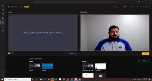
The Microsoft Teams collaboration platform is popular among UF/IFAS faculty, researchers, Extension agents, and staff for its ease of use and utility for internal and external communication, collaboration, and meetings. The Teams webinar feature called live events can be used for a more controlled experience for large meetings, events, or CEU delivery. This new 5-page article will discuss the benefits and possible limitations of this service, specifically for offering online CEU material that meets Florida Department of Agriculture and Consumer Services (FDACS) guidelines for such trainings. Written by Brett W. Bultemeier and Joe Gasper and published by the UF/IFAS Pesticide Information Office.
https://edis.ifas.ufl.edu/pi290
Tag: Information Technology
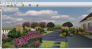
Landscape Design Software: Evaluation and Recommendations for Homeowners

Homeowners who are computer literate and want to improve their landscapes often consider purchasing software so that they can create the design themselves and save money. To help you select a program from the dozens that are available, each with different levels of cost and difficulty, UF/IFAS scientists tested seven popular do-it-yourself programs, compared them to a professional landscape design software program, and rated them for quality of features and ease-of-use. This 9-page fact sheet written by Gail Hansen, Smith Watkins, and Sydney Park Brown and published by the Department of Environmental Horticulture will help you estimate costs, ensure compatibility with your Windows-based or Apple-based operating system, and compare reviews from consumer websites so that you can choose the software that best fits your needs.
edis.ifas.ufl.edu/ep526
The Role and Impact of Technology on Supply-Chain Management in the Food Industry
 In competitive markets, innovations such as electronic devices, information technology, and green and sustainable technologies can provide a competitive advantage in managing the supply chain, and determine which operations succeed and which fail. The information in this article is intended to provide insight regarding the potential benefits and limitations of these technologies so that firms in the food industry can make more informed decisions on which technologies should be incorporated into their own systems and to what degree. This 5-page fact sheet was written by Jonathan A. Watson, Allen F. Wysocki, and Ray A. Bucklin, and published by the UF Department of Agricultural and Biological Engineering, April 2015. (UF/IFAS photo: Thomas Wright)
http://edis.ifas.ufl.edu/ae511
Eye-Tracking Methodology and Applications in Consumer Research
 Eye-tracking technology is a means of exploring the relationship between visual attention and consumer behavior. In the past, eye-tracking technology has been used to conduct research on consumer decision-making, marketing, and advertising. This 5-page fact sheet serves as an introduction to eye-tracking technology and methodology. Written by Hayk Khachatryan and Alicia L. Rihn, and published by the UF Department of Food and Resource Economics, July 2014.
http://edis.ifas.ufl.edu/fe947
Forest Resource Information on the Internet: Connecting to Today’s On-line Resources
 In 1997, the UF/IFAS School of Forest Resources and Conservation (SFRC) published Forest Resource Information on the Internet, which provided detailed information about the Internet: its history, structure, and how to use it. It also provided a sample of forest resource websites. Much has changed since the first publication. This is the third revision of this document, providing updated information on the latest landowner assistance websites available. These state, regional, and national resources can serve as a springboard to a wide variety of natural resource information and programs. This 4-page fact sheet was written by Chris Demers, and published by the UF Department of School of Forest Resources and Conservation, May 2014.
http://edis.ifas.ufl.edu/fr182
Mapping Your World with Community Analyst: An Easy to Use Tool to Map the Characteristics of U.S. Communities
 In recent years, the number of mapping and geospatial tools that are both feature-rich and easy to use has increased. This is good news because it allows many more of us to capitalize on the power and unique insights that such tools can provide without having to spend inordinate amounts of time learning how to use them. This article presents Community Analyst, a web application that provides access to thousands of business, demographic, economic, education, and health data variables for the United States. The application’s extensive suite of data metrics, in conjunction with on-demand reports and interactive color-coded maps, allows one to quickly explore the characteristics of one or more geographic areas. This 9-page fact sheet was written by Robert Swett and Lisa Krimsky, and published by the UF Department of School of Forest Resources and Conservation, October 2014.
http://edis.ifas.ufl.edu/fr383
There Is a Safety App for That! – Some Useful Agricultural Safety Apps
 An estimated 58 billion apps will be downloaded to smartphones and 14 billion to tablets in 2013. This 4-page fact sheet explores key features in smartphones and some available apps that can enhance the safety of agricultural operations. The apps presented represent a small fraction of the apps available on various platforms. Written by Michael T. Jensen, and published by the UF Department of Agricultural and Biological Engineering, August 2013.
http://edis.ifas.ufl.edu/ae498
Introduction to Geographic Information Systems (FOR288/FR356)
 A GIS can be used in land management to document existing conditions, plan future operations, and archive completed work. Farming applications include soil productivity for different crops, crop yield prediction, and determining fertilizer and pesticide application rates. Forestry applications include estimating forest stand acreage, determining forest stand characteristics, and determining where to harvest. This 4-page fact sheet was written by John Lagrosa, Chris Demers, and Michael Andreu, and published by the UF Department of School of Forest Resources and Conservation, March 2012.
http://edis.ifas.ufl.edu/fr356
Forest Resource Information on the Internet: Connecting to Today’s On-line Resources (FOR124/FR182)
 The original 1997 version of this fact sheet provided detailed information about the Internet: its history, structure, and how to use it. It also provided a sample of forest resource websites. This is a third version of this fact sheet, providing updated information on the latest landowner assistance websites available. These state, regional, and national resources can serve as a springboard to a wide variety of natural resource information and programs. Written by Chris Demers and published by the UF Department of School of Forest Resources and Conservation, May 2011.
http://edis.ifas.ufl.edu/fr182
An Introduction to Freely Available Street Network Data (FOR281/FR343)
Projects in agricultural and natural resource management, urban planning, and community development typically use some kind of spatial data for analysis and mapping. Applications and websites exist which allow the user to view spatial data and perform some basic spatial operations (e.g., compute the distance between two locations). This 6-page fact sheet focuses on data sources that allow users to download free street data for further processing and analysis. Written by Hartwig H. Hochmair and Dennis Zielstra, and published by the UF Department of School of Forest Resources and Conservation, March 2011.
http://edis.ifas.ufl.edu/fr343
FOR226/FR288 Comparison of Urban Forest Tree Inventory and Management Software Systems
FOR-226, a 13-page illustrated fact sheet by Michael G. Andreu, Erin M. Brown, Melissa H. Friedman, Robert J. Northrop, and Mary E. Thornhill, examines many of the tree inventory software systems available as of 2009. It provides up-to-date information about previously existing tree inventory software systems as well as those recently launched. Includes references. Published by the UF School of Forest Resources and Conservation, August 2009.
http://edis.ifas.ufl.edu/FR288
SL296/SS509 Citrus Cold Weather Protection and Irrigation Scheduling Tools Using Florida Automated Weather Network (FAWN) Data
SL-296, an 8-page illustrated fact sheet by John L. Jackson, Kelly Morgan and William R. Lusher, provides an overview of the water saving tools that are available to citrus growers on the FAWN Web site — the Cold Protection Toolkit and the citrus microsprinkler irrigation scheduler. Published by the UF Department of Soil and Water Sciences, September 2009.
http://edis.ifas.ufl.edu/SS509
SGR-102/SG085 A Computer-Directed Geographic Coastal Use Classification System for Ecologic Planning: The Case of the Florida Keys
SGR-102, a 104-page illustrated report by Gustavo A. Antonini, Leonard Zobler, and Robert Swett, presents a baywater assimilation-capacity approach to coastal zone management, using the Florida Keys (Stock Island) as a case study. Originally published April 1992 by the Florida Sea Grant College Program.
http://edis.ifas.ufl.edu/SG085
