Planning for Recreational Waterway Access in Rural Coastal Settings

A pier in the Florida Keys.

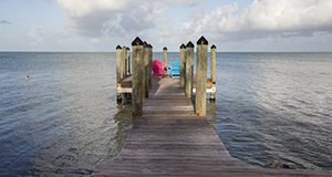
Increasing demand for waterfront land throughout the United States is a long-term trend with a profound impact on the public's ability to access coasts and waterways for recreation. Overcrowding at beaches, boat ramps, and popular destinations in Florida's densely populated coastal areas leads more Floridians and tourists to consider recreating in rural coastal communities that still offer the solitude and natural settings desired by many. According to a recent report sponsored by the Outdoor Industry Association, the provision of public water access has increased outdoor recreation tourism, which could bring much-needed economic benefits to rural areas. However, many of these communities lack planning resources to measure local support and user needs and to estimate the benefits that investments in public-access infrastructure might bring. This 6-page fact sheet written by Corina Guevara, Charles Sidman, Robert Swett, and Alan Hodges and published by the Florida Sea Grant College Program describes an approach those communities can use to characterize user needs and to quantify local economic benefits derived from public-access infrastructure with a focus on boat ramp facilities.
http://edis.ifas.ufl.edu/sg141

Maps of Charlotte County General Permit Trafficshed Channels and Secondary Channels

cover of publicationThis 33-page collection of maps depicts channels included in the Charlotte County General Permit (GP)1. Each map shows either channel segments within a GP trafficshed or segments in a GP secondary channel system. Written by Robert A. Swett, David A. Fann, and Elizabeth Staugler, and published on EDIS by Florida Sea Grant, October 2014.
http://edis.ifas.ufl.edu/sg133

Mapping Your World with Community Analyst: An Easy to Use Tool to Map the Characteristics of U.S. Communities

Figure 1.  Standard geographies available in Community Analyst for summarizing dataIn recent years, the number of mapping and geospatial tools that are both feature-rich and easy to use has increased. This is good news because it allows many more of us to capitalize on the power and unique insights that such tools can provide without having to spend inordinate amounts of time learning how to use them. This article presents Community Analyst, a web application that provides access to thousands of business, demographic, economic, education, and health data variables for the United States. The application’s extensive suite of data metrics, in conjunction with on-demand reports and interactive color-coded maps, allows one to quickly explore the characteristics of one or more geographic areas. This 9-page fact sheet was written by Robert Swett and Lisa Krimsky, and published by the UF Department of School of Forest Resources and Conservation, October 2014.
http://edis.ifas.ufl.edu/fr383

Coastal and Marine Spatial Planning (SGEF178/SG111)

Page 1 of PDFCoastal and marine spatial planning can assist Florida’s residents and visitors with balancing the many uses and activities associated with our coastal and ocean resources. One example at work in Florida is the Regional Waterway Management System in southwest Florida, an objective approach to waterway planning and permitting based on mapped channel depths. Marine spatial planning has also successfully allowed shipping lanes near Boston Harbor to be reconfigured to reduce collisions with endangered North Atlantic right whales, which migrate northward to feed from their calving grounds off the Florida and Georgia coasts. This 2-page fact sheet was written by Robert A. Swett , and published by the UF Department of Sea Grant, July 2010.
http://edis.ifas.ufl.edu/sg111

SGEB57/SG098 Navigational, Historical and Environmental Perspective of Jupiter Inlet and the Loxahatchee River

SGEB-57, a 2-page full-color map by David A. Fann, Robert A. Swett, and Michael J. Grella, uses natural-color aerial photographs along with historic pictures and maps to help visitors and residents enjoy and appreciate what they can see and access from recreational vessels in the Jupiter Inlet vicinity. Published by the Florida Sea Grant Program, June 2009.
http://edis.ifas.ufl.edu/SG098

TP124/SG082 A Manual of Methods and Procedures for the Regional Waterway Management System

Revised! TP-124, a 91-page illustrated manual by Robert Swett and David Fann, details the procedures that are necessary to complete a Regional Waterway Management System for Florida’s coastal canals and other waterways. Includes references. Published by the Florida Sea Grant College Program, March 2008.
http://edis.ifas.ufl.edu/SG082

SGEB63/SG097 Navigational, Historical, and Environmental Perspective of Charlotte County Waterways

SGEB-63, a 2-page full-color map and guide by David A. Fann, Robert A. Swett, and Elizabeth Staugler, using natural-color aerial photographs, along with historic pictures and maps to help visitors and residents enjoy and appreciate what they can see and access from recreational vessels. Published by the Florida Sea Grant Program, September 2008.
http://edis.ifas.ufl.edu/SG097

An Assessment of Florida Boaters and their Awareness of the Clean Vessel Act and Clean Marina Program (TP151/SG069)

This revised 83-page report provides results from a study to determine boater awareness of the Clean Vessel Act (CVA) and Clean Marina Program, changes in awareness of the CVA since a 1998 assessment, and the practices and attitudes of Florida boaters. The report concludes with recommendations on how to better target future educational and outreach efforts among the general boating population. Written by Robert Swett, Susan Fann and Jan DeLaney, and published by the UF Sea Grant Program, March 2009.
http://edis.ifas.ufl.edu/sg069

TP107/SG083 A Recreational Boater-Based Method for Re-designing the NOS Small-Craft Chart

New to EDIS! TP-107, a 145-page illustrated project report by Gustavo Antonini, Niels West, Charles Sidman, and Robert Swett, reports on a project to determine chart information which would satisfy criteria for safe, modern navigation and promote environmental stewardship. The prototype chart covers the southwest Florida coast from lower Tampa Bay to Charlotte Harbor. Published by the Florida Sea Grant Program, December 2000. Reviewed March 2008.
http://edis.ifas.ufl.edu/SG083

SGEF139/SG084 A Recreational Boater-Based Method for Re-designing the NOS Small-Craft Chart (Executive Summary)

New to EDIS! SGEF-139, a 16-page executive summary by Gustavo Antonini, Niels West, Charles Sidman, and Robert Swett, summarizes a project designed to determine the chart information needs of boaters which satisfy safe navigation and promote stewardship of coastal resources. Published by the Florida Sea Grant College Program, December 2000. Reviewed March 2009.
http://edis.ifas.ufl.edu/SG084

SGR-102/SG085 A Computer-Directed Geographic Coastal Use Classification System for Ecologic Planning: The Case of the Florida Keys

SGR-102, a 104-page illustrated report by Gustavo A. Antonini, Leonard Zobler, and Robert Swett, presents a baywater assimilation-capacity approach to coastal zone management, using the Florida Keys (Stock Island) as a case study. Originally published April 1992 by the Florida Sea Grant College Program.
http://edis.ifas.ufl.edu/SG085