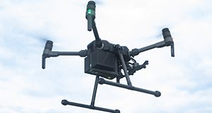
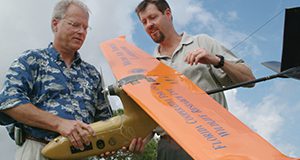
This 5-page document provides guidance on the appropriate use of unmanned aerial vehicles (UAVs) for agricultural applications in Florida. It contains step-by-step instructions for preparing a UAV for flight, creating a mission path (using flight mission planning apps), and collecting UAV-based data. Written by Sri Charan Kakarla, Leon De Morais Nunes, and Yiannis Ampatzidis, and published by the UF/IFAS Department of Agricultural and Biological Engineering, November 2019.
http://edis.ifas.ufl.edu/ae535
Tag: UAVs
Postflight Data Processing Instructions on the Use of Unmanned Aerial Vehicles (UAVs) for Agricultural Applications
Remote sensing applications for agriculture often require periodically collected high-resolution data, which are difficult to obtain by manned flights or satellite imagery. This 6-page document provides guidance on the use of post-processing software to visualize data collected by unmanned aerial vehicles (UAVs) for agricultural applications. It provides step-by-step instructions for using the data collected from a UAV flight to create several types of maps and indices. Written by Sri Charan Kakarla and Yiannis Ampatzidis, and published by the UF/IFAS Department of Agricultural and Biological Engineering, October 2019.
http://edis.ifas.ufl.edu/ae533
Instructions on the Use of Unmanned Aerial Vehicles (UAVs)
All research and commercial activities involving the use of UAVs must be conducted in compliance with applicable federal and state laws, statutes, and regulations. This new 5-page document provides guidance on the appropriate use of unmanned aerial vehicles (UAVs) or unmanned aircraft systems (UAS) in Florida. Written by Sri Charan Kakarla and Yiannis Ampatzidis, and published by the UF/IFAS Department of Agricultural and Biological Engineering, October 2018.
http://edis.ifas.ufl.edu/ae527

