FRAGSTATS: A Free Tool for Quantifying and Evaluating Spatial Patterns

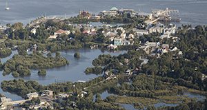
Aerial photograph of Cedar Key, Florida.

Human activities such as urbanization and agriculture have triggered rapid land cover change, resulting in the loss of natural ecosystems. Land managers managers seeking to plan effectively for future land use that preserves biodiversity and the valuable services provided by natural ecosystems must understand land cover change and its environmental impacts. Quantifying patterns of land cover change objectively in order to understand them can be difficult without the proper resources, however. This 9-page fact sheet written by Benxin Chen and Basil V. Iannone III and published by the UF/IFAS School of Forest Resources and Conservation introduces one such resource, a free software called FRAGSTATS. Readers will learn to create input data, run the FRAGSTATS software, and interpret outputs. A few basic concepts of landscape ecology and GIS are included, but this fact sheet is intended for readers with at least some GIS knowledge.
https://edis.ifas.ufl.edu/fr431
Quantum GIS (QGIS): An Introduction to a Free Alternative to More Costly GIS Platforms

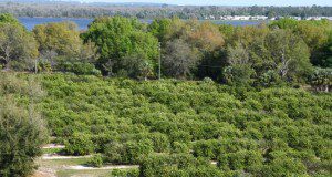
A University of Florida orange grove in Lake Alfred, FL

Geographic information system (GIS) software packages can be prohibitively expensive, causing many to shy away from mapping and spatial analysis. This 7-page fact sheet written by Jeffry M. Flenniken, Steven Stuglik, and Basil V. Iannone III and published by the UF/IFAS School of Forest Resources and Conservation introduces the reader to a free GIS software package called Quantum GIS (QGIS), walking the reader through simple GIS processes that can be used to visualize spatial patterns of importance to a variety of fields, including natural resources, agriculture, and urban planning. Learn how to create a land-cover map for a county of interest and create heatmaps that illustrate the density of a given attribute (Florida Springs for this example). This publication will benefit those interested in incorporating GIS into their work but who are unable to afford expensive proprietary GIS software packages, as well as anyone interested in learning a new GIS software package.
https://edis.ifas.ufl.edu/fr428

A New Database on Trait-Based Selection of Stormwater Pond Plants

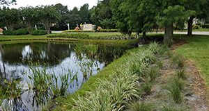
stormwater pond plants

Stormwater ponds play critical roles for flood control and water quality treatment, and they can provide ecological services to communities. Those ecological services can be enhanced with proper pond design and maintenance. This 6-page fact sheet written by Gisele P. Nighswander, Mary E. Szoka, Kayla M. Hess, Eban Z. Bean, Gail Hansen de Chapman, and Basil V. Iannone III and published by the UF/IFAS School of Forest Resources and Conservation provides a comprehensive database of plant traits to help readers make informed stormwater pond plant selection decisions based on their own relative priorities.
http://edis.ifas.ufl.edu/fr416